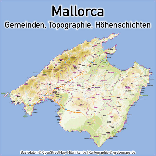
Vektorkarte Mallorca mit Topographie, Gemeindegrenzen, Höhenschichten
Vektorkarte Mallorca mit Topographie, Gemeindegrenzen und Höhenschichten für touristische Zwecke
Vektorkarte Mallorca mit Topographie, Gemeindegrenzen und Höhenschichten für touristische Zwecke
| Cookie | Dauer | Beschreibung |
|---|---|---|
| cookielawinfo-checkbox-necessary | 11 months | This cookie is set by GDPR Cookie Consent plugin. The cookies is used to store the user consent for the cookies in the category "Necessary". |